Griffin Island
post by jefftk (jkaufman) · 2023-10-07T18:40:06.642Z · LW · GW · 3 commentsThe park near our house has an interesting sign:
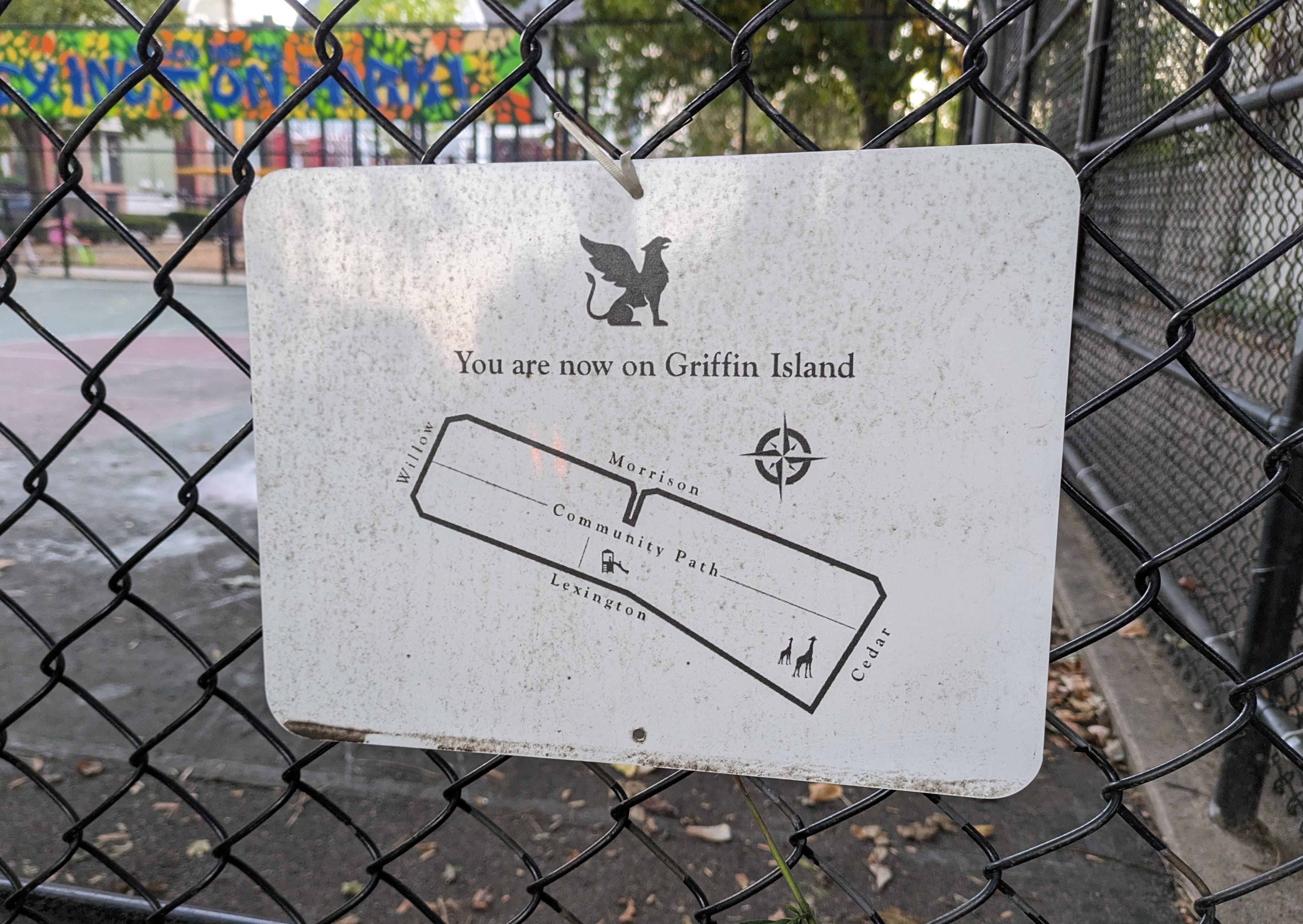
A parent put it up, labeling the area you're able to explore from this point without crossing any streets. It's the large red area on my child walksheds map.
The name has caught on well, and it's very useful to be able to refer to this block!
Yesterday I added it to OpenStreetMap and Google Maps and I now see it in both.
3 comments
Comments sorted by top scores.
comment by Marc Bliss (marc-bliss) · 2024-01-15T17:21:42.470Z · LW(p) · GW(p)
I was pleasantly surprised to find this post. I took a video of my cat and saw that it was geotagged as Griffin Island, which I had never heard before. A quick google search led me to your blog and the explanation therein. So curious about the origin of the name or the original sign poster. Any context there? Griffin Island represent!
Marc, 81 Lex
Replies from: jkaufman↑ comment by jefftk (jkaufman) · 2024-01-15T19:47:35.952Z · LW(p) · GW(p)
After writing this I learned that the sign had been put up by Stephanie, a local parent and safer-streets advocate.
comment by agnesnutter · 2023-10-23T14:43:46.056Z · LW(p) · GW(p)
Love it! I submitted Griffin Island to Apple Maps and it is now there (at certain zoom levels) :)
Too bad the Google Maps item is necessarily a pin rather than a region. I wonder if there’s any way to get around that restriction and submit it as a “neighborhood”/“residential area” like Apple and OSM accept.